 Polish Polar DataBase
Keyword
infrared imaging, orthophotomap
Type of resources
Available actions
Topics
Keywords
Contact for the resource
Provided by
Representation types
Update frequencies
status
From
1
-
1
/
1
-
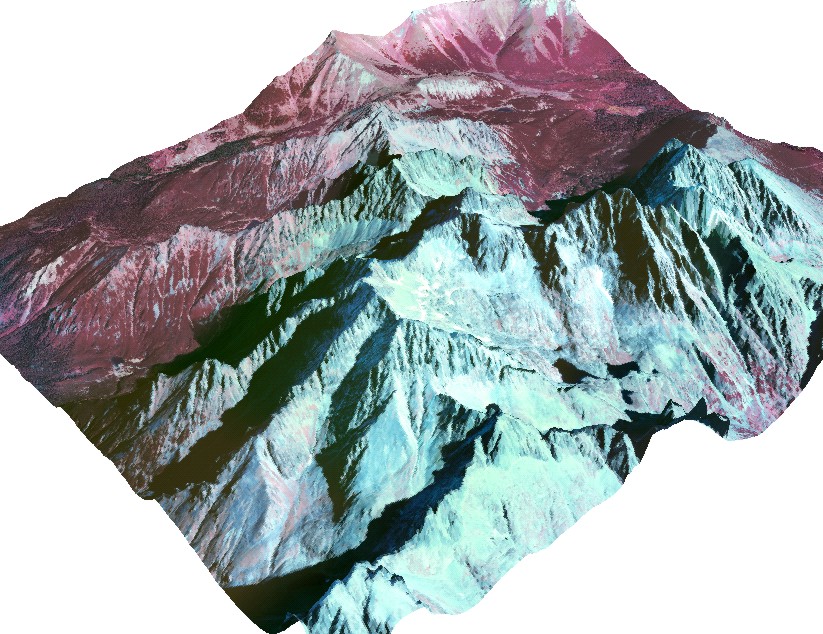
The orthophotomap was prepared on the basis of infrared aerial photographs taken by EUROSENSE in September 1998. The study covers the Dolina Kiezmarskej Bieley vody valley located in the High Tatra Mountains (Slovakia). Cartographic projection: Universal Transverse Mercator, Ellipsoid: WGS 84, Coordinates system: UTM zone 34. The project was financed by No.3P04E 045 23. Editors: Bogdan Gądek, Milan Koren (sen.), Milan Koren (jun.) The project was financed by the Polish Commitee on Scientific Research under term of research grant No. 3P04E 045 23.